Tom Wilson1; Joe Kwan 2 1Senior Implementation Manager, Earth Science Information Systems 2 Environmental Advisor, MMG Rosbery
Hydrogeology in Mining – A One Day Conference | Australian Institute of Geoscientists (aig.org.au)
Abstract Submission
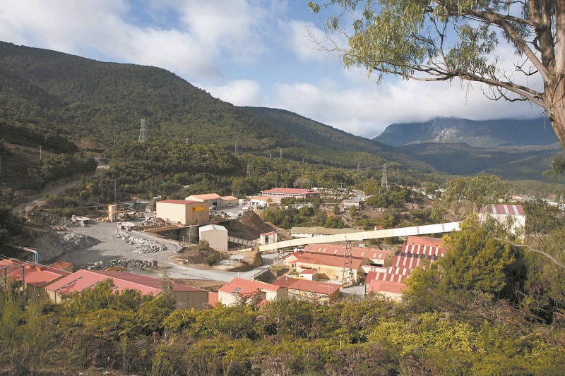
Rosebery is an underground polymetallic base metal mine operated by MMG and is located in the township of Rosebery, Tasmania, approximately 300 north-west of Hobart. It has operated continuously since 1936 with current mine life extending beyond 2020. Zinc, lead and copper concentrate and gold dore is produced at Rosebery using mechanized underground mining methods and crushing, grinding and flotation processes.
The groundwater flow system comprises a deep fractured aquifer (which contains the mine voids), overlain by surficial glacial deposits and weathered material. Interaction between surface waters and groundwater has been observed across the catchment, with 17% of precipitation infiltrating as groundwater to subsequently be discharged as baseflow into creeks and rivers.
To monitor surface water and groundwater quality at the site, a network of over 60 groundwater monitoring wells and approximately 40 surface water sampling locations have been established. Groundwater monitoring occurs biannually to assess seasonal variability in quality, while surface water monitoring occurs as often as weekly at some locations.
Historical monitoring data extends to 1990, providing a valuable information source to identify long term water quality trends. The historical data set grows with each new monitoring event. Efficient management of the large monitoring data set is paramount given license conditions imposed on the mine. Confidence in the data accuracy is crucial in forming the basis for interpretation and subsequent operational decisions.
MMG has adopted an Environmental Data Management System (EDMS) comprising the following ‘off-the-shelf’ components produced and supplied by Earth Science Information Systems:
ESdat LSPECS – a complete field program management system used to generate Sampling and Analysis Quality Plans, manage field program delegation, scheduling and post-field validation as well as all stages of laboratory interaction (including e-quotes, e-COC, e-SRN and laboratory reports)
pLog – a tablet based application that synchronizes with LSPECS (via the cloud) allowing complete field data capture, including water levels, field parameters, field observations, sample information and even well logs and construction details
ESdat Desktop – client based software accepting and compiling data from myriad sources, including LSPECS generated and validated field program data, logger data, historical data and environmental standards. ESdat Desktop allows rapid data interrogation and map based querying as well as generation of a wide range of standard reports, such as comparison tables, time series graphs and hydro-chemical plots, such as stiff and piper diagrams.
MMG has implemented the EScIS EDMS with great success, with key benefits including:
- Centralized on-site storage of all Environmental data in a single SQL data base
- Easy-to-use and powerful querying of long term historical data to identify trends, generate timely responses to ad-hoc regulator requests or share data with consultants
- Complete electronic data capture and lab interaction (primary and secondary labs)
- Real productivity gains, allowing transition of effort from manipulation to interpretation

You can view the Powerpoint Slide presentation used at the conference here